HUSTers In Action: Lifeline Radio System Amidst The Floods
HUST technology in action right at the flood control station!
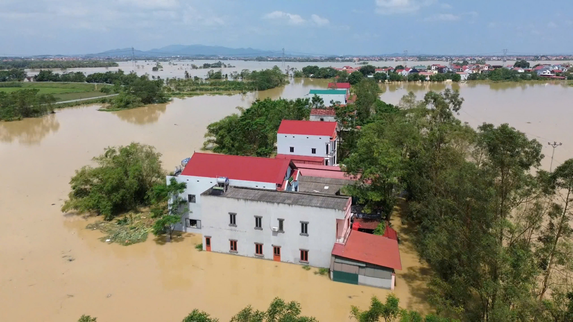
During the September 2024 floods, Assoc. Prof. Do Trong Tuan and students from the Department of Communication Engineering, HUST School of Electrical and Electronic Engineering, worked tirelessly to implement their mobile radio communication system in the flooded areas of Dien Loc village, Hoa Tien commune, Yen Phong district, and Tan Tien village, Cao Duc commune, Gia Binh district in Bac Ninh province.
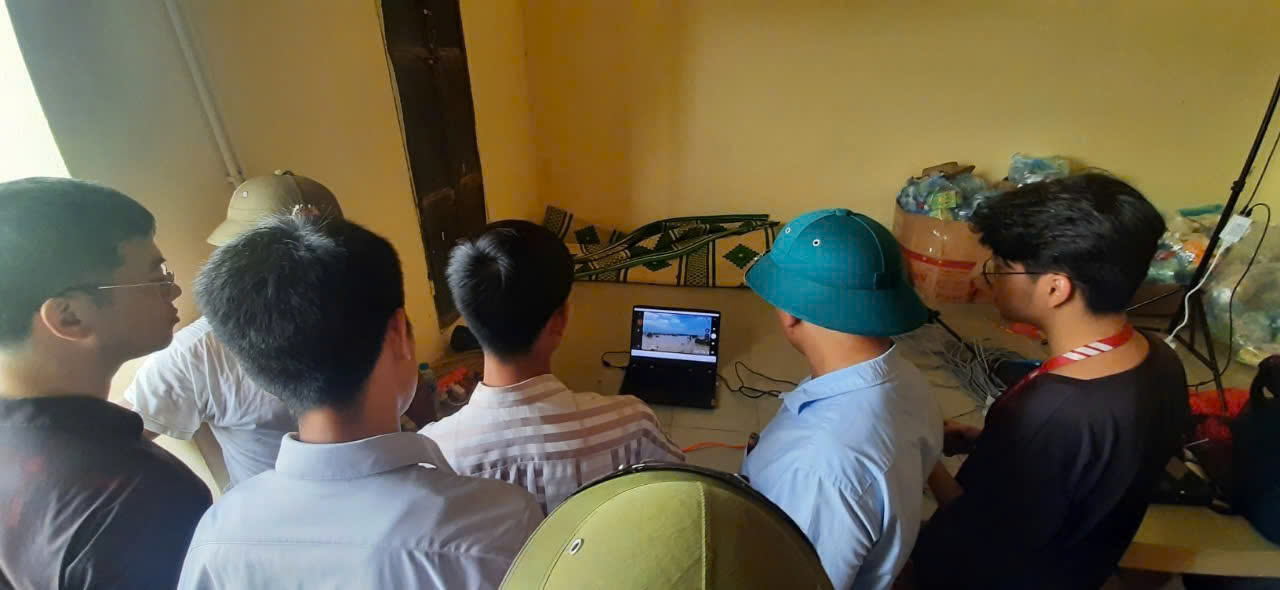
This system facilitated data collection and real-time visual display for command teams, enabling effective communication and coordination through remote connections. The collected data allowed for precise location tracking of those in need of rescue, and post-rescue data could generate images for processing and create maps to assess damage and prioritize recovery efforts.
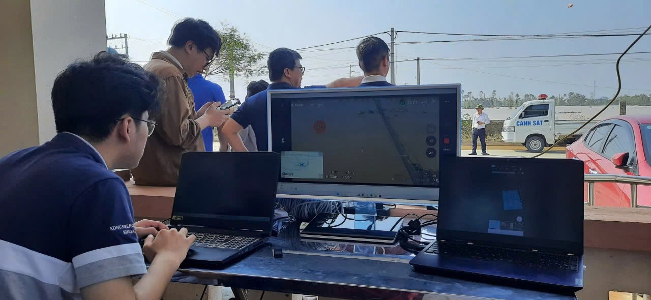
Assoc. Prof. Do Trong Tuan emphasized the rapid setup of equipment in flood zones, crucial for urgent rescue operations. At the Cau Gang command station in Yen Vi, the team established their system in just 35 minutes and completed data collection within another 30 minutes. With better infrastructure, deployment could be even faster.
After setup, HUST faculty and students operated drones to survey the terrain and assess flooding in the isolated Dien Loc village. The drones transmitted high-resolution images in real-time, providing vital location and situational data for effective rescue planning. The collected imagery was stored for future analysis.
HUSTers always believe in fulfilling their community responsibility through hands-on projects that apply scientific research in real-world contexts. These initiatives provide students with practical lessons, enhancing their critical thinking, experimental methods, teamwork skills, and the ability to successfully complete tasks. Through this approach, research continues to evolve, leading to technological advancements.
The greatest act of generosity is dedicating time to others and the community, sharing knowledge and a positive attitude towards life. This principle guides the HUST community - Responsible, Innovative, Honorable, and Outstanding.
| * On 16/09/2024, Assoc. Prof. Huynh Quyet Thang, President of HUST, signed a decision to establish a task force aimed at supporting local areas in rescuing regions isolated by flooding using smart drones and intelligent time-lapse cameras developed and applied by HUST. * Earlier, on September 11, 2024, in response to the call from the Ministry of Education and Training and the Vietnam Education Union, HUST donated 200 million VND to assist the people in Northern Vietnam in recovering from the aftermath of natural disasters. |
English edit: Khanh Phuong
Author: Gia Hân
Newer articles
Older articles
-
 Hanoi University of Science and Technology Joins Alliance to...
-
 The First Internationally Standardized Design Factory Model...
-
 The Reunion of Over 2,000 Talented Students at Hanoi...
-
 Hanoi University of Science and Technology Graduates...
-
 Enterprise's Trust in Hanoi University of Science and...
-
 20 Petrolimex Scholarships Awarded, 20 Future Aspirations...
-
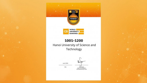 Hanoi University of Science and Technology Moves Up in the...
-
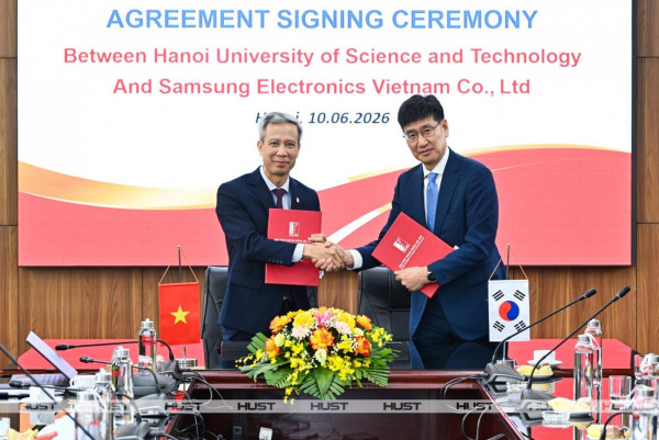 Hanoi University of Science and Technology and Samsung...
-
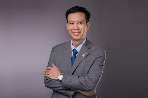 Prof. Le Anh Tuan Appointed as HUST President
-
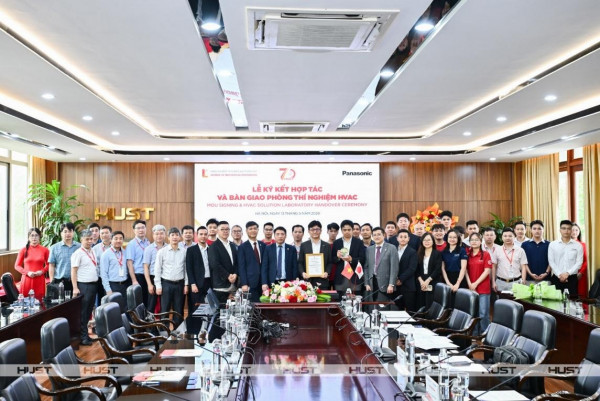 HUST and Panasonic Vietnam Collaborate to Develop HVAC Human...